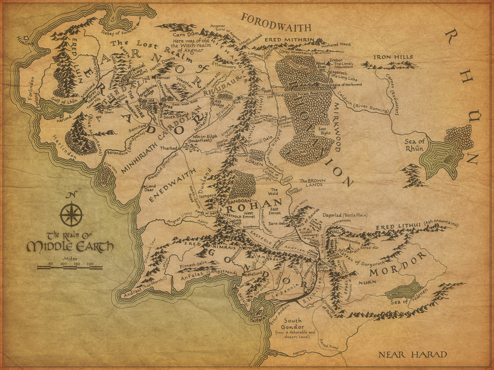
EDIT: wow yes you all do, this is amazing
Inspired by eightbitsamurai's comment here.
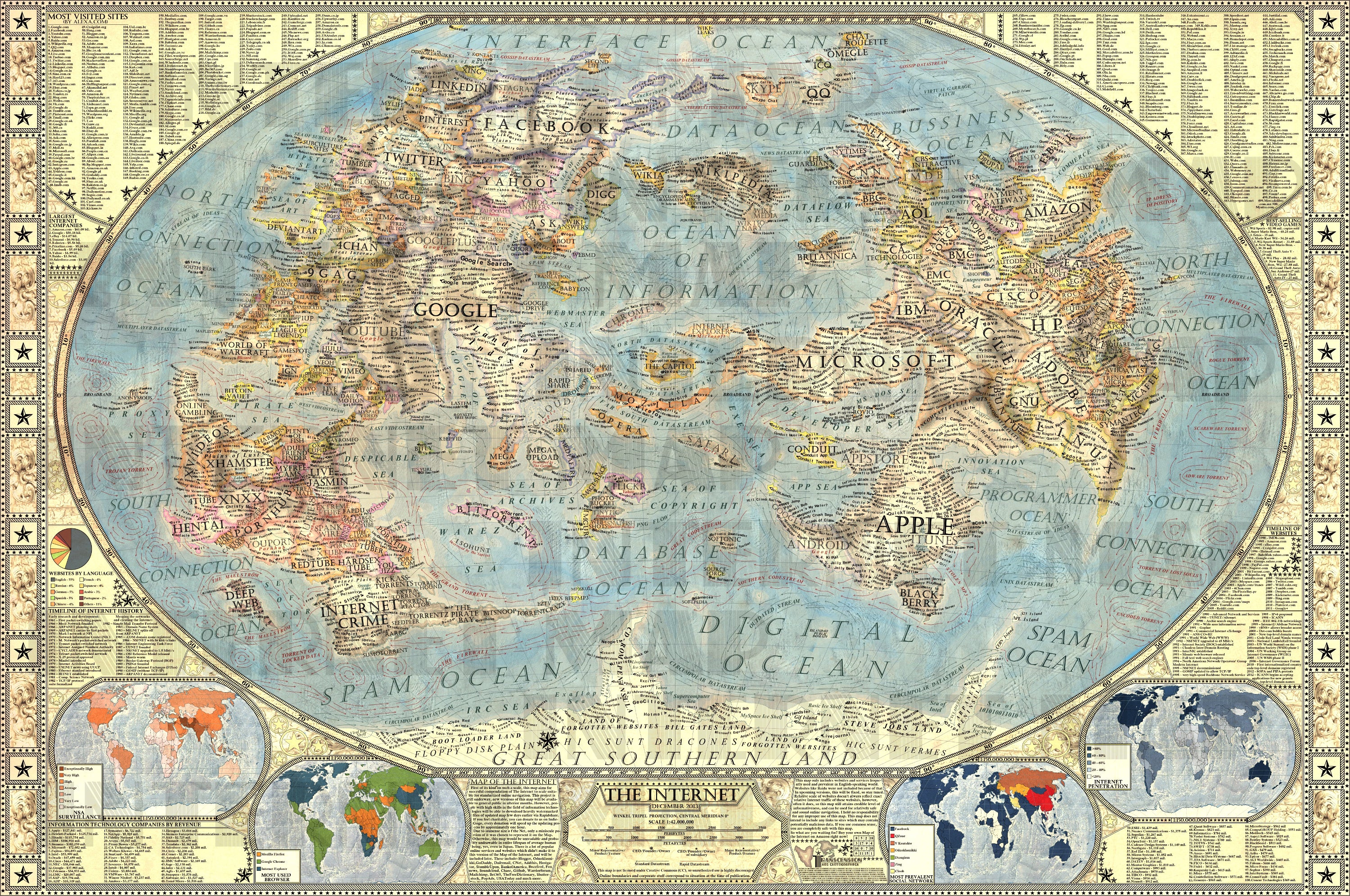
Personally always been a fan of:
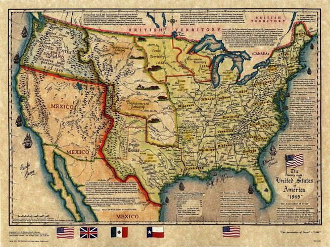
Couldn't find the exact 19th century Texas map I really enjoy looking at, but this is a good substitute, informative and aesthetic:
Honorable mention to the various maps detailing the impact on coastal cities of ice shelves melting.
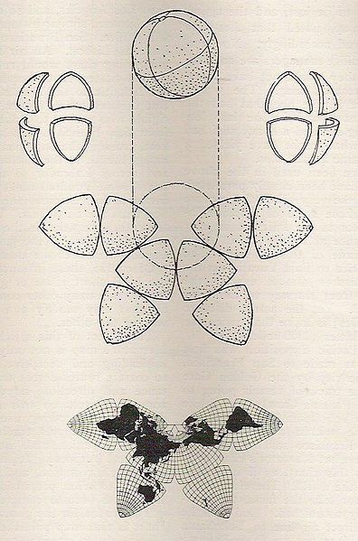
Absolutely. This is the Cahill Butterfly projection: For some reason this is the one that captures the idea of "this is the world" to me. It's just plain gorgeous as well. Here's another way of looking at it: And here's some more information of the progression of it to what became the Waterman Projection and also the Cahill-Keyes Projection

My favourite map is the first cartographic attempt at mapping the Americas: Waldseemüller map: An entire book was written about it, and it is worth the read. Google Books has a complete copy online.
It is a bit hard to imagine, but I always loved the reversed earth. Another one I love is the live map of earth's wind patterns http://earth.nullschool.net/#current/wind/isobaric/1000hPa/o...
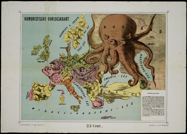
I just made a post there that would better fit here. As a bonus, the amazing 1870 'Humoristische Oorlogskaart' or humored war map. Beautiful anthromorphized countries.
Does anyone seriously think that the developers of Zelda ever attempted to create a consistent geographic world where all the games take place? I always felt like they sacrificed a consistent geographic world for more freedom in crafting the world of each game. Plus, they can always explain away any discrepancies with the fact that each game takes place hundreds or thousands of years apart from each other. But then there's Termina- no one can really agree on what or where that is.
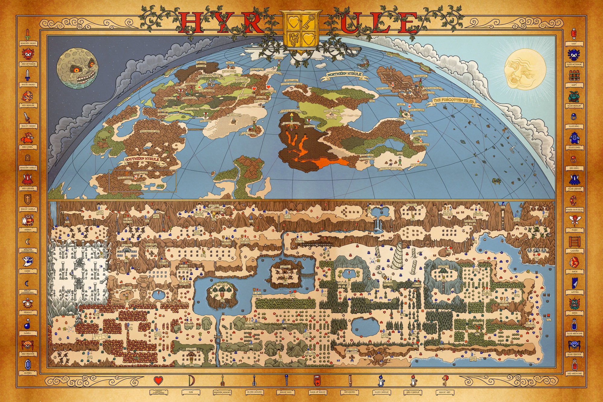
Yes, there's an actual geographical world that all of the games take place in. And more or less it's the same world every time, with the specific details being different for the sake of gameplay. Zelda (as are all Nintendo games) is designed with gameplay in mind first, and story/lore/world being in second. Which is why it tends to vary. But in the map I posted, that little bit down at the bottom (the zoomed in part), that's "Hyrule" for 99% of the games. The zoomed out part consists of "greater hyrule" which is only really explored in Zelda 2, after Hyrule is disbanded and the people spread out. The islands off to the right of that map shouldn't actually be there. The islands are actually just the mountains/high points of the map, after the world is flooded. And they should really be overlaid on top of lesser/south hyrule. That's why I said the map was inaccurate. As for termina, my personal theory is that it is underneath (literally) Hyrule. Similar to Subrosia and how the pirate ship sticks through the world. Pic 1: http://static2.wikia.nocookie.net/__cb20090616033533/zelda/i... Pic 2: http://static2.wikia.nocookie.net/__cb20090616033629/zelda/i... We know subrosia is beneath/under Holodrum. And judging by how you get to termina from hyrule, it seems to be a similar case. And the stone tower with it's reversed gravity just strengthens the argument. And with the release of Link Between Worlds, you can see that the concept art also shares this idea: And in lorule (underneath hyrule) there are many similarities and hints towards termina. Like the crazy mask people, the parallel people, and the dismissing of the gods and triforce. So yea, they dismiss a bit of geographic detail in favor of gameplay. But most of it is relatively the same. You have death mountain in the north, lake hylia to the south, and the gerudo desert to the west. Castle town is northish, and lon lon ranch is smack dab in the middle. Then you got lost woods and kakariko village. Sure, they shift around a bit, but they are generally in the same relative locations.
The exact geographical location (in terms of Link's physical position) is somewhere between Holodrum, Labrynna, and Hyrule. Popular theory is that it's between east and west greater hyrule. There's a theory that someone posted which I particularly like, that speculates that Koholint (the island in Link's Awakening) was actually "sucked up" and would be east greater hyrule. There's a lot pointing to it, but nothing officially confirmed. Also, Koholint itself, being a dream, is based on LTTP's hyrule. The dev reason was due to it originally going to be a remake, but then it became it's own game.
So is the lake in the middle of the Zelda 1 map Lake Hylia? Also, are the locations in Skyward Sword and Twilight Princess the same locations as their analogues in other Zelda games, just with different names (e.g. Eldin Volcano is Death Mountain, Faron Woods are the Lost Woods, Lanayru Desert is the Gerudo Valley area etc.). I honestly always thought that each game had a forest, desert, and mountain themed area, as well as a lake in order to incorporate the traditional gameplay elements of the series. It seems so obvious now that each game takes place in the same place. I like that Termina theory by the way.
yup. And if you look, you can see that there's an island/dungeon in the middle of both of them (from Zelda 1, as well as OoT, TP, LTTP, and LBW). Yup. It's a bit hazy, but they generally line up to the same areas. But IIRC the lake and desert areas are flipped. Which is an example of tweaking the geography to suit gameplay. Yup, about 70% of the geography lines up. Hell, even Wind Waker you can see the areas line up. With Dragonroost island being Death Mountain, and so on. Thanks. It's a bit controversial in the fandom. But I personally like it.So is the lake in the middle of the Zelda 1 map Lake Hylia?
Also, are the locations in Skyward Sword and Twilight Princess the same locations as their analogues in other Zelda games, just with different names (i.e. Eldin Volcano is Death Mountain, Faron Woods are the Lost Woods, Lanayru Desert is the Gerudo Valley area etc.)
I honestly always thought that each game had a forest, desert, and mountain themed area, as well as a lake in order to incorporate the traditional gameplay elements of the series. It seems so obvious now that each game takes place in the same place.
I like that Termina theory by the way.
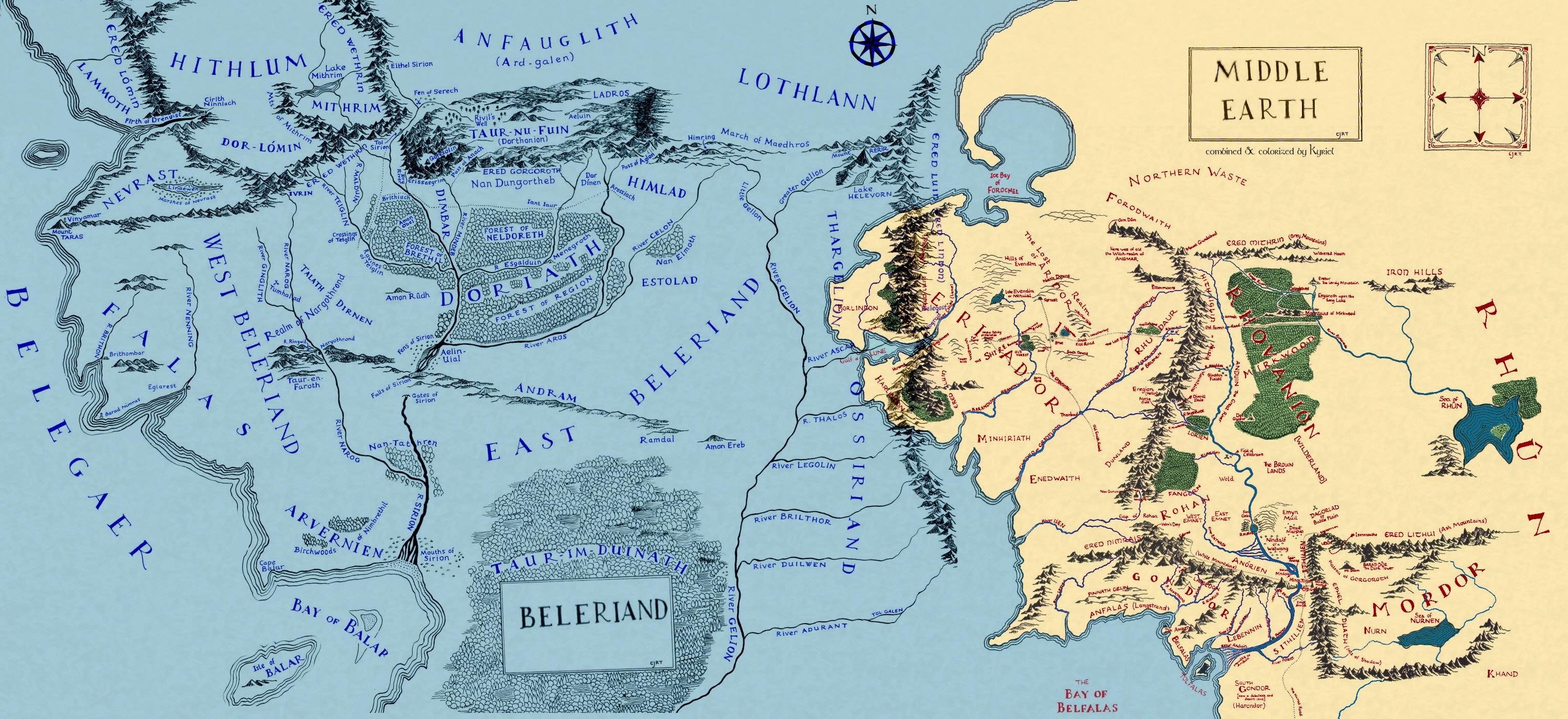
It was from the LOTR wiki Beleriand article; I believe it is a fan-made combination of the maps from the beginning of LOTR and The Silmarillion. Tolkien never made many maps of his world, especially not outside of Beleriand and LOTR-era western Middle-earth, so most maps you'll see on the internet are fan-made.

