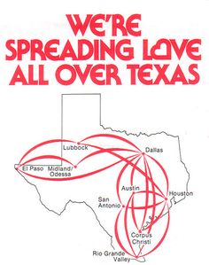
...see, and that's the sort of cartography that made me flay a Thomas Guide all over my walls and connect the Metro stops with colored yarn. No part of that conveys information in an easy-to-read way. It's worshipful of the network but dismissive of the users. Much like rail in general. It's interesting to compare rail coverage maps with airline coverage maps. Rail maps are all about straight lines and orderly bends and inflicting their geometry on the world (which is usually completely absent from the imagery). Air maps use great circles even where they make absolutely no goddamn sense - "we're above all that" but because you necessarily have to travel from the endpoint once you get there, air maps are very much a part of the existing cartography. "We'll land here which is close to where you need to be!" as opposed to "here's a stop. It is an indeterminate distance from other stops. What's around that stop is completely irrelevant because the only thing that matters is where our lines stop." Rail, in the US at least, refuses to be a part of multimodal transportation. Bus terminals are rarely where rail terminals are and I once spent an hour and a half on two bus lines trying to get from the airport to the Amtrak station in Portland. If you're on the train, if you're on the subway, if you're on the Metro that's all you're doing. You're going from station to station and that's it. Even when it's completely illogical to show things to scale, the airlines try and show things to scale. You might be above the world, but you're still connected to it.

Well, I never said why I liked those maps. It wasn't for their usability that's for sure. It took quite some time, but public transport maps seem to have found some balance. Pretty much all maps except subway maps take geography into account in one way or another. The default transit line map over here are completely geographical ones like this , with a bunch of transit agencies opting for fully designed line maps like this gorgeous and usable Utrecht map. It incorporates a lot of the geographical features of the city and is very readable considering the various things it aims to show (frequencies, 4 types of bus lines, limited services, all stops and transfers, rivers, urban areas, and even train services). Can that be attributed to their poor reliability? Probably not entirely; what little experience I have with (North) American public transport makes me wonder whether the potential of proper multimodal transit is valued enough. I didn't see a lot of bus/subway hubs in NYC, for example. And when I wanted to visit family in Edmonton from Calgary I had to - walk to the bus - take the bus to the campus - walk 10 minutes across campus in the freezing cold to the campus tram stop - take the tram to the city center - take another tram to some desolate businesspark - walk another fifteen minutes to the bus terminal - get on a Greyhound bus that took me to another desolate businesspark in Edmonton (stopping in 4 minor towns for around 15 minutes per stop) - get picked up by family and drive 35 minutes back the same road I came by bus The whole ordeal took like 6, maybe 7 hours? The second time I got a Car2Go to the Greyhound terminal, shaving an hour off the trip. The third time I got a rental and drove all the way in less than three hours. It's safe to say buses on your side of the Atlantic have an...image problem. You've mentioned that it's for the poor before, but I do wonder now if this lack of multimodality might be one of the root causes. I believe I heard the statistic somewhere that 80% of all train rides are multimodal PT over here (counting tram, buses, subways and bicycles as the other modes). So most of the popular and profitable bus lines are actually feeder lines to and from train stations. Could it be that the lack of bus multimodality is part of the reason why buses in the U.S. have such low ridership? If it's only local lines, it can't achieve a critical mass where it starts to make some money instead of only costing money. Once you have some popular lines, you can start a virtous cycle of improving the quality and quantity of transit, which leads to better ridership, which leads to more investments in quality/quantity, etc.Rail, in the US at least, refuses to be a part of multimodal transportation.